Wetlands, dunes, forests, coastal views, wild flowers, remote beaches, rockpools and swim spots (avoid this walk during high tides and swells)
15 km – easy day walk with some paved sections, boardwalk, sand, rocks and some hills
Directions
- Catch the bus 14 from the city to Wommara Avenue Belmont North just before Railway Crescent/Kalaroo Rd (make sure it doesn’t terminate at Charletown)
- Turn left into Railway Crescent and walk towards Belmont Wetlands (if you feel like some extra walks) and the Fernleigh track where you will turn left to head north towards Redhead
- You will walk through some beautiful wetlands but to your right there is some industry (sorry for the smells) and just past the industry you’ll arrive at a park with a stop sign
- Turn right and walk past the carpark and to the right of the oval there is a clubhouse with shady trees to aim for and a path to the road.
- Once you reach the main road (Elsdon Rd) turn right and soon after you will see a park coming up on your left. Follow the side road next to the park which is a continuation of Elsdon Rd.
- At the end of the road you will see a trail about 10 metre to the left of the cnr. This is Owen’s Trail and you will turn left to head towards Redhead Beach but first of all there is a lovely bridge over the wetlands just to the right if you want to take a peak
- At the end of Owen’s Trail you can turn right to head to the beach but then you have to head back up to Beach Rd, so eventually you will go left up past a nice picnic spot with playground.
- Cross over Beach Rd, and walk along to Alison Rd where you will turn left and follow it all the way to the end and then continue following the road around to the right at the top of the hill (it becomes Collier Rd). There is a path away from the road which you follow almost all the way to the end of the street.
- Opposite Kay Lane you will find a small track to left with a sign listing restrictions… Turn left into this track and follow it for quite a while through Awabakal Nature Reserve. Keep left where necessary and enjoy the views and flowers.
- You will eventually arrive at a T junction with a much wider track at the top of a ridge. It is worth going right to have a look at the view but then head back to the left where you will see a picnic table.
- Continue along the path to the right of the picnic table, go through a gate and you will arrive at the end of Ocean St where there are lots of fancy houses and a bus stop for the 48 bus you can catch back to Charletown if you have had enough walking (then catch the 14 back to the centre of Newcastle)
- Turn right into Tumut St, at the end turn left into Goulburn St, the first right into Bombala St which you follow to the end
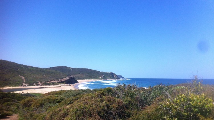
- At the end of the street there is a path with a map of Glenrock. Take a photo of the map if you have a camera and continue to follow signs to the beach
- Walk along the beach until you can see a wooden structure and large path leading to the carpark. Walk through the carpark and along the road about 20 metres where there is a the locked gate leading to a trail.
- Following this trail through the forest and turn right when you come to a T-intersection then soon after follow the Link trail left up the hill.
- Just before a gate take the track to your right and follow this around to join with the main trail and continue along and down the hill. At one point a few tracks seem to meet and it can be hard to know the path. Look for stairs going down the rock to continue down towards the beach.
- Walk along Burwood beach and around the rock platform to Merewether beach
INSERT MAP
